Description
Eastbound Fortune Rd across from the Osceola County Health Department.
Nearest Businesses
- Florida Department of Health in Osceola County
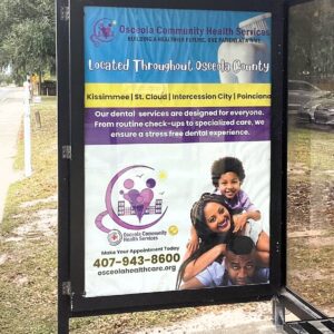
- Osceola Community Health Services
- Fortune Road Dental
- Walgreens Pharmacy
- 7-Eleven convenience store
- Flora Family Vet
Quick-service spots like 20 Plus Wings, Rodeo Diner, El Asadora Mexican Food, Di Carlo Restaurant, Mighty Wings
Other: Small local services, residential neighborhoods, apartments, and community spots; denser retail, dining, and commercial west/south toward US 192 and central Kissimmee.
Traffic Counts
|
Segment
|
AADT
|
Year
|
|---|---|---|
|
Fortune Road near Simpson Rd / Boggy Creek Rd area
|
30,000–40,000
|
2025
|
|
Fortune Road broader segments in Kissimmee
|
25,000–35,000
|
2025
|
|
Nearby connectors (e.g., Simpson Rd, Boggy Creek Rd)
|
15,000–25,000
|
2025
|
Daily Impressions Potential: 30,000–40,000 vehicles daily (plus pedestrian/bus exposure), generating tens of thousands of views. Eastbound targets traffic toward residential areas and local connectors.
Trends: Moderate volumes with growth from residential development, healthcare draw, and local commuting; congestion at key intersections like Simpson Rd/Fortune Rd; includes local vehicles, families, and commuter traffic. Peaks during rush hours, weekdays (health services/appointments), and weekends.
Demographics (ZIP 34744 – Kissimmee Area, immediate vicinity)
Latest from U.S. Census American Community Survey 2024 5-year estimates and 2026 projections:
- Population: ~66,000–67,000 (2024 est.); projected ~70,000–71,000 for 2026 (density ~2,000 per sq. mile in suburban pockets).
- Age: Median ~36–38 years (family-oriented: strong under-18 and 25–54 groups).
- Gender: ~49% male, ~51% female.
- Race/Ethnicity: White (non-Hispanic) ~20–30%; Hispanic/Latino ~55–65% (significant Puerto Rican and other Latin influences); Black/African American ~8–12%; Asian ~3–5%; two or more/other ~5–10%.
- Income and Economy: Median household income ~$70,000–$75,000; median individual ~$30,000–$35,000. Poverty rate ~12–15%. Top industries: tourism/hospitality, retail, healthcare, construction. Unemployment ~4–6%; many commute to Orlando/theme parks (20–40 min average).
- Households and Housing: Average size ~3.0–3.2; median home value ~$300,000–$350,000; median rent ~$1,500–$1,800/month. ~45–50% married/family households.
- Education: ~20–25% with college degree or higher.
Diverse, family-oriented, multicultural area with strong Hispanic influence and mix of local residents, commuters, and seasonal/tourist workers (English and Spanish dominant). Residents and visitors use nearby healthcare, pharmacy, convenience, dining, and services—ideal for health services, family, food, community, or convenience messaging.